
Preparing for the Unexpected: Emergency Response Innovations in Major Cities

Jan 28
min read
Navi is your AI guide to the real world. Ask what to do, where to go, or how to get there, and Navi instantly creates personalized plans, safer routes, and relevant recommendations based on walkability, context, and your preferences — so exploring feels effortless and informed.
“Navi feels like a local friend who knows exactly what I’m in the mood for — I ask a question and instantly get great places and routes.”

“I finally know which routes actually feel safe to walk. Navi completely changed how confident I feel exploring new neighborhoods.”

“Instead of juggling maps, lists, and reviews, Navi plans my entire day in one place — it’s how I start every outing now.”


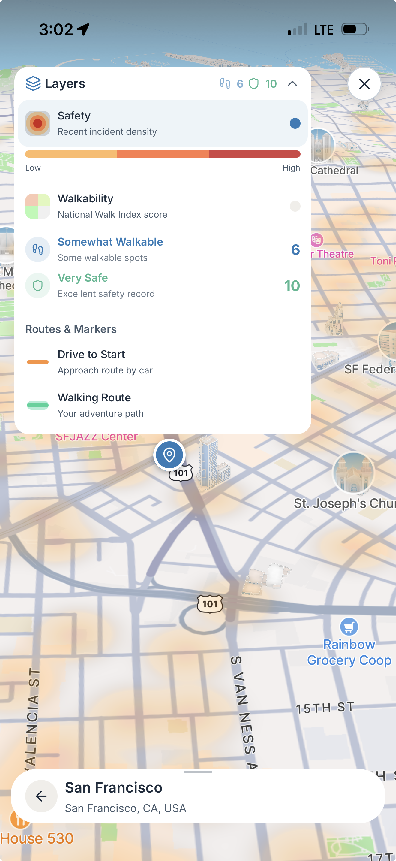
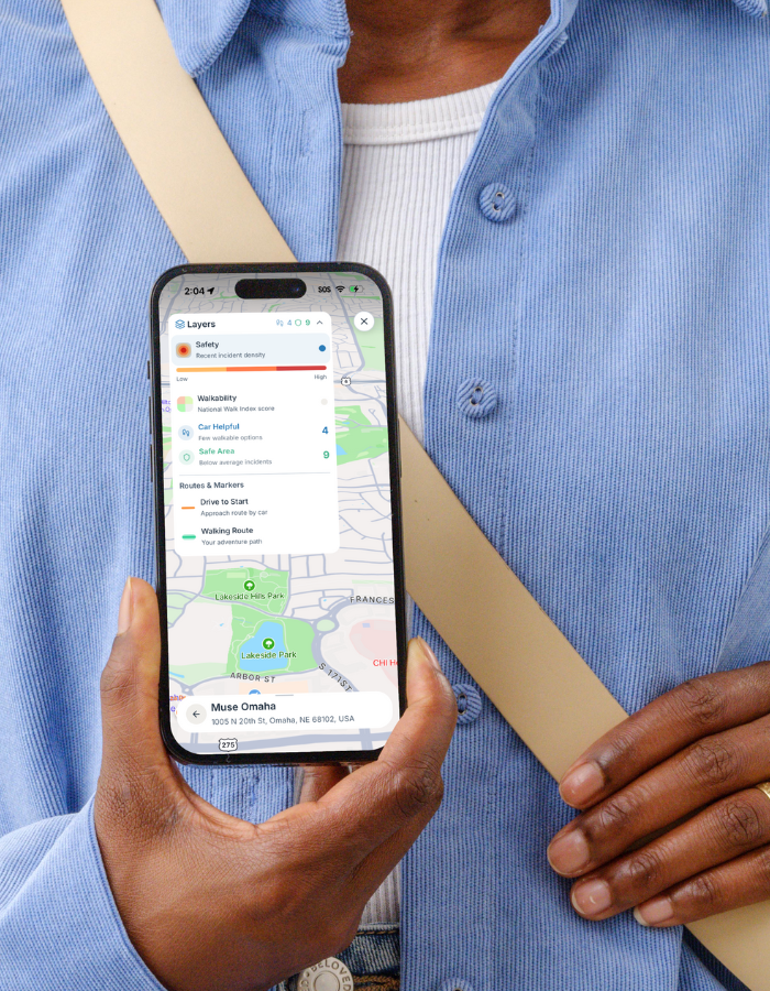
Most maps tell you where things are. Navi tells you what they’re like. Safety, walkability, vibe, and relevance — combined into one clear signal. Navi is more than maps, its real-world context for your day.

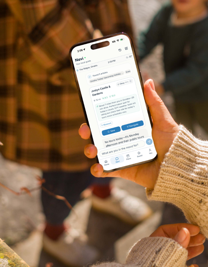
Navi doesn’t just respond — it designs your day. Ask a question and get a plan: places, routes, and timing tailored to you. All of these recommendations based your preferences.
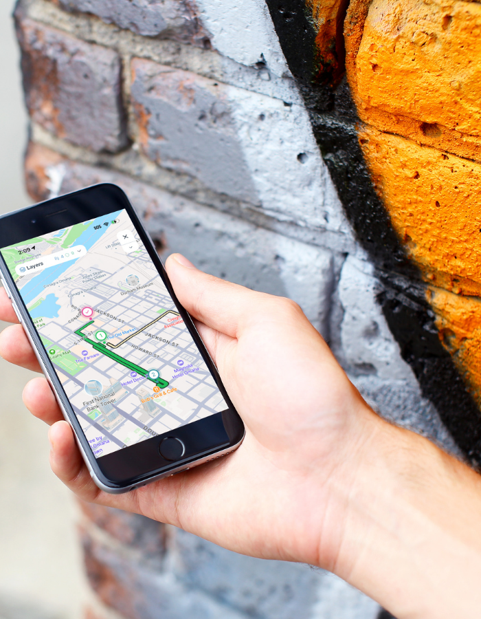
Not all routes are equal — Navi shows you the ones that feel right based on your vibes. Choose paths based on safety, poplularity, and walkability — not just distance.
Navi filters the city through your preferences, not ads or popularity. Your vibe, your budget, your moment — without endless scrolling.
Every recommendation is grounded in real data and trusted sources like Reddit, OpenTable, Micheilin Guide, and others. Scores, collections, and signals that make decisions feel obvious.
Navi is for anyone who wants to explore with confidence, stay connected, and make their community safer. Navi is building real-time pedestrian navigation data in cities worldwide.
Explore new places with peace of mind. Check safety and walkability scores, while using Navi to plan your day like a local
Walk smarter every day. With Navi, explore new areas and find different experiences that include trusted recommendations.
Stay connected and safe on and off campus. See where friends are, share your location, mark hazards, and know everyone made it home.
Cities are full of signals, but most tools leave you guessing. Navi brings safety, walkability, and local context together into one clear view, so you can make confident decisions without second-guessing where to go or how to get there.
Understand how a place feels — not just where it is — with real-time safety, walkability, and relevance layered directly into your experience.
Choose paths based on comfort and confidence, not just speed. Navi highlights the safest, most walkable ways to move through a city.
.png)
Trends in walking for leisure and transportation is increasing with 58% of adults walking for leisure in the last 7 days with over 2 billion users on navigation apps monthly.